
Pequot Lakes topographic map
Click on the map to display elevation.
About this map
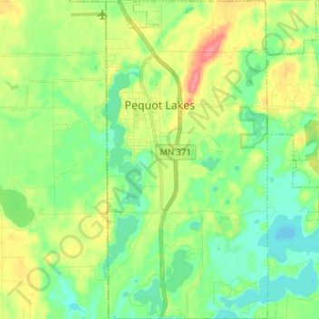
Name: Pequot Lakes topographic map, elevation, terrain.
Average elevation: 383 m
Minimum elevation: 360 m
Maximum elevation: 425 m
Other topographic maps
Click on a map to view its topography, its elevation and its terrain.
Middle Cullen Lake
United States > Minnesota > Crow Wing County > Pequot Lakes
Average elevation: 372 m