
Thank you for supporting this site ❤️
Make a donation
Make a donation
Hiltons topographic map
Click on the map to display elevation.
Thank you for supporting this site ❤️
Make a donation
Make a donation
About this map
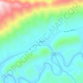
Name: Hiltons topographic map, elevation, terrain.
Location: Hiltons, Scott County, Virginia, United States (36.63455 -82.48709 36.67455 -82.44709)
Average elevation: 513 m
Minimum elevation: 374 m
Maximum elevation: 927 m
Thank you for supporting this site ❤️
Make a donation
Make a donation
Other topographic maps
Click on a map to view its topography, its elevation and its terrain.