
Thank you for supporting this site ❤️
Make a donation
Make a donation
Macon topographic map
Click on the map to display elevation.
Thank you for supporting this site ❤️
Make a donation
Make a donation
About this map
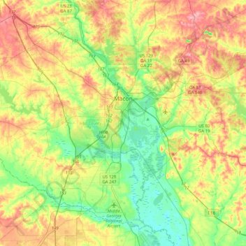
Name: Macon topographic map, elevation, terrain.
Location: Macon, Bibb County, Georgia, United States (32.66064 -83.89205 32.95287 -83.48943)
Average elevation: 127 m
Minimum elevation: 69 m
Maximum elevation: 208 m
Thank you for supporting this site ❤️
Make a donation
Make a donation