
Thank you for supporting this site ❤️
Make a donation
Make a donation
Beulaville topographic map
Click on the map to display elevation.
Thank you for supporting this site ❤️
Make a donation
Make a donation
Beulaville
Beulaville is located on the coastal plain of North Carolina in Duplin County. It is situated at 85 feet (26 m) above sea level, with only minimal changes in topography. Limestone Creek, a small body of water that runs into the Northeast Cape Fear River at Hallsville, borders the western boundary of town. Beulaville is 90 miles (140 km) southeast of Raleigh and 312 miles (502 km) south of Washington, D.C.
Thank you for supporting this site ❤️
Make a donation
Make a donation
About this map
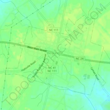
Name: Beulaville topographic map, elevation, terrain.
Location: Beulaville, Duplin County, North Carolina, United States (34.91302 -77.79222 34.93343 -77.75812)
Average elevation: 27 m
Minimum elevation: 18 m
Maximum elevation: 31 m
Thank you for supporting this site ❤️
Make a donation
Make a donation
Other topographic maps
Click on a map to view its topography, its elevation and its terrain.