
Thank you for supporting this site ❤️
Make a donation
Make a donation
Fröjdadal topographic map
Click on the map to display elevation.
Thank you for supporting this site ❤️
Make a donation
Make a donation
About this map
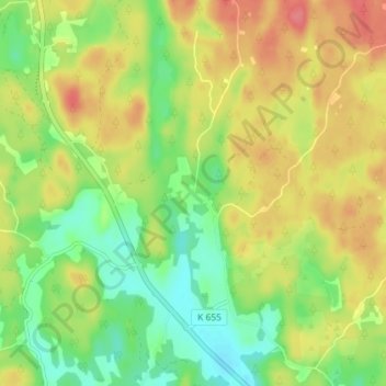
Name: Fröjdadal topographic map, elevation, terrain.
Location: Fröjdadal, Ronneby kommun, Blekinge County, Sweden (56.28934 15.18230 56.32934 15.22230)
Average elevation: 67 m
Minimum elevation: 34 m
Maximum elevation: 103 m
Thank you for supporting this site ❤️
Make a donation
Make a donation
Other topographic maps
Click on a map to view its topography, its elevation and its terrain.