
Thank you for supporting this site ❤️
Make a donation
Make a donation
Norway topographic map
Click on the map to display elevation.
Thank you for supporting this site ❤️
Make a donation
Make a donation
About this map
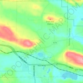
Name: Norway topographic map, elevation, terrain.
Location: Norway, Dickinson County, Michigan, 49870, United States (45.77684 -87.94440 45.82396 -87.88260)
Average elevation: 311 m
Minimum elevation: 271 m
Maximum elevation: 399 m
Thank you for supporting this site ❤️
Make a donation
Make a donation
Other topographic maps
Click on a map to view its topography, its elevation and its terrain.