
Thank you for supporting this site ❤️
Make a donation
Make a donation
Ash topographic map
Click on the map to display elevation.
Thank you for supporting this site ❤️
Make a donation
Make a donation
About this map
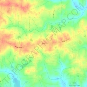
Name: Ash topographic map, elevation, terrain.
Location: Ash, Paulding County, Georgia, 30140, United States (33.78372 -84.87022 33.82372 -84.83022)
Average elevation: 319 m
Minimum elevation: 290 m
Maximum elevation: 347 m
Thank you for supporting this site ❤️
Make a donation
Make a donation
Other topographic maps
Click on a map to view its topography, its elevation and its terrain.