
Sarıyahşi topographic map
Interactive map
Click on the map to display elevation.
About this map
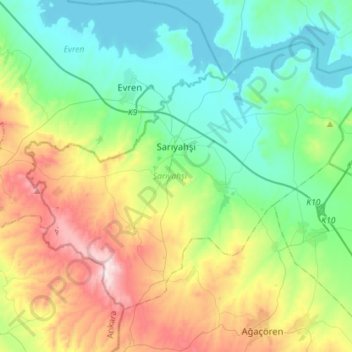
Name: Sarıyahşi topographic map, elevation, terrain.
Location: Sarıyahşi, Aksaray, Central Anatolia Region, Turkey (38.88204 33.72315 39.05093 34.00818)
Average elevation: 1,057 m
Minimum elevation: 841 m
Maximum elevation: 1,559 m
Sarıyahşi is a town and district of Aksaray Province in the Central Anatolia region of Turkey, at a distance of 110 km (68 mi) from the province seat of Aksaray. According to 2000 census, population of the district is 12,120 of which 7,751 live in the town of Sarıyahşi, and the remainder in surrounding villages.[3] The district covers an area of 280 km2 (108 sq mi),[4] and lies at an average elevation of 870 m (2,854 ft).
Other topographic maps
Click on a map to view its topography, its elevation and its terrain.