
Make a donation
Indian Heaven Wilderness topographic map
Click on the map to display elevation.
Make a donation
Indian Heaven Wilderness
Lava once flowed from the numerous volcanic cones that rise above the plateau, consisting mainly of overlapping shield volcanoes, spatter cones, and cinder cones, which averages 4,500 feet (1,400 m) in elevation. The wilderness' highest point is Lemei Rock (5,927 ft), whose crater now contains Lake Wapiki. Other prominent volcanic peaks include Bird Mountain, Sawtooth Mountain, Gifford Peak, East Crater, and Red Mountain. Big Lava Bed is the result of the most recent volcanic activity about 8,200 years ago.
Make a donation
About this map
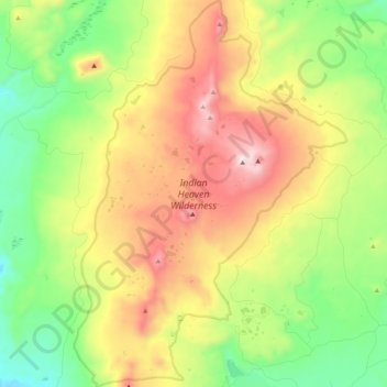
Name: Indian Heaven Wilderness topographic map, elevation, terrain.
Average elevation: 1,191 m
Minimum elevation: 791 m
Maximum elevation: 1,768 m
Make a donation
Other topographic maps
Click on a map to view its topography, its elevation and its terrain.
Make a donation
Make a donation