
Balen topographic map
Interactive map
Click on the map to display elevation.
About this map
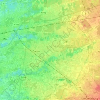
Name: Balen topographic map, elevation, terrain.
Location: Balen, Turnhout, Antwerpen, Vlaanderen, 2490, België (51.13262 5.08871 51.21143 5.26225)
Average elevation: 35 m
Minimum elevation: 16 m
Maximum elevation: 58 m
Other topographic maps
Click on a map to view its topography, its elevation and its terrain.