
黑河市 topographic map
Interactive map
Click on the map to display elevation.
About this map
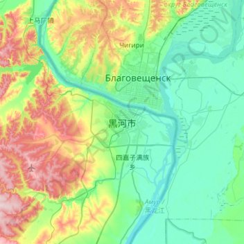
Name: 黑河市 topographic map, elevation, terrain.
Location: 黑河市, 兴安街道办事处, 爱辉区, 黑河市, 黑龙江省, 中国 (50.07222 127.33469 50.39222 127.65469)
Average elevation: 174 m
Minimum elevation: 114 m
Maximum elevation: 348 m