
Thank you for supporting this site ❤️
Make a donation
Make a donation
Mugla topographic map
Click on the map to display elevation.
Thank you for supporting this site ❤️
Make a donation
Make a donation
About this map
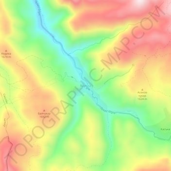
Name: Mugla topographic map, elevation, terrain.
Location: Mugla, Smolian, Smolyan, Bulgaria (41.59682 24.47223 41.63682 24.51223)
Average elevation: 1,565 m
Minimum elevation: 1,295 m
Maximum elevation: 1,842 m
Thank you for supporting this site ❤️
Make a donation
Make a donation
Other topographic maps
Click on a map to view its topography, its elevation and its terrain.