
Thank you for supporting this site ❤️
Make a donation
Make a donation
Kamu topographic map
Click on the map to display elevation.
Thank you for supporting this site ❤️
Make a donation
Make a donation
About this map
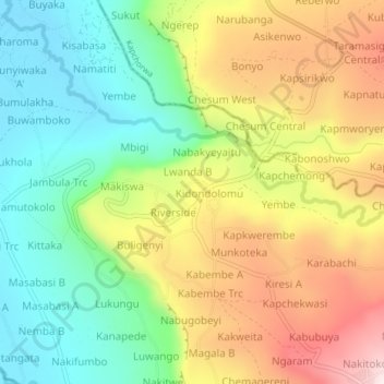
Name: Kamu topographic map, elevation, terrain.
Location: Kamu, Bugisa sub-region, Bulambuli, Eastern Region, Uganda (1.28550 34.30209 1.32550 34.34209)
Average elevation: 1,310 m
Minimum elevation: 1,080 m
Maximum elevation: 1,626 m
Thank you for supporting this site ❤️
Make a donation
Make a donation