
Thank you for supporting this site ❤️
Make a donation
Make a donation
Monroe Center topographic map
Click on the map to display elevation.
Thank you for supporting this site ❤️
Make a donation
Make a donation
About this map
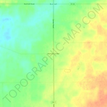
Name: Monroe Center topographic map, elevation, terrain.
Location: Monroe Center, Ashtabula County, Ohio, United States (41.82428 -80.59244 41.86428 -80.55244)
Average elevation: 277 m
Minimum elevation: 256 m
Maximum elevation: 298 m
Thank you for supporting this site ❤️
Make a donation
Make a donation
Other topographic maps
Click on a map to view its topography, its elevation and its terrain.
Thank you for supporting this site ❤️
Make a donation
Make a donation
Thank you for supporting this site ❤️
Make a donation
Make a donation