
Thank you for supporting this site ❤️
Make a donation
Make a donation
Stephens topographic map
Click on the map to display elevation.
Thank you for supporting this site ❤️
Make a donation
Make a donation
About this map
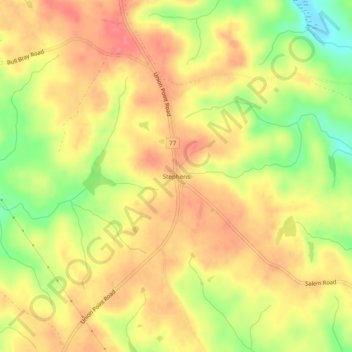
Name: Stephens topographic map, elevation, terrain.
Location: Stephens, Oglethorpe County, Georgia, 30667, United States (33.77484 -83.18154 33.81484 -83.14154)
Average elevation: 223 m
Minimum elevation: 180 m
Maximum elevation: 249 m
Thank you for supporting this site ❤️
Make a donation
Make a donation