
Thank you for supporting this site ❤️
Make a donation
Make a donation
Wargówko topographic map
Click on the map to display elevation.
Thank you for supporting this site ❤️
Make a donation
Make a donation
About this map
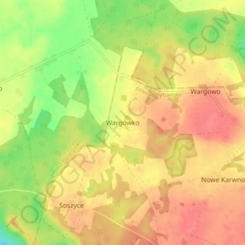
Name: Wargówko topographic map, elevation, terrain.
Average elevation: 106 m
Minimum elevation: 68 m
Maximum elevation: 131 m
Thank you for supporting this site ❤️
Make a donation
Make a donation
Other topographic maps
Click on a map to view its topography, its elevation and its terrain.
Jezioro Ryńskie
Poland > Pomeranian Voivodeship > Bytów County > Kłączno > Rynszt
Average elevation: 162 m