
Thank you for supporting this site ❤️
Make a donation
Make a donation
Bundy topographic map
Click on the map to display elevation.
Thank you for supporting this site ❤️
Make a donation
Make a donation
About this map
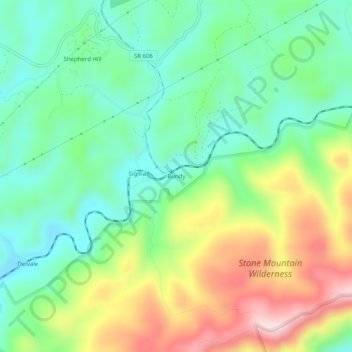
Name: Bundy topographic map, elevation, terrain.
Location: Bundy, Lee County, Virginia, 24265, United States (36.80981 -82.95100 36.84981 -82.91100)
Average elevation: 696 m
Minimum elevation: 566 m
Maximum elevation: 931 m
Thank you for supporting this site ❤️
Make a donation
Make a donation
Other topographic maps
Click on a map to view its topography, its elevation and its terrain.