
Thank you for supporting this site ❤️
Make a donation
Make a donation
Stony Point topographic map
Click on the map to display elevation.
Thank you for supporting this site ❤️
Make a donation
Make a donation
About this map
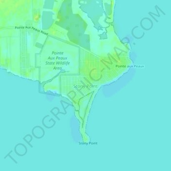
Name: Stony Point topographic map, elevation, terrain.
Location: Stony Point, Monroe County, Michigan, United States (41.93087 -83.29488 41.95215 -83.25314)
Average elevation: 173 m
Minimum elevation: 170 m
Maximum elevation: 181 m
Thank you for supporting this site ❤️
Make a donation
Make a donation
Other topographic maps
Click on a map to view its topography, its elevation and its terrain.
Berlin Township
United States > Michigan > Monroe County > Berlin Township > Berlin Township
Average elevation: 177 m