
Thank you for supporting this site ❤️
Make a donation
Make a donation
Wagener topographic map
Click on the map to display elevation.
Thank you for supporting this site ❤️
Make a donation
Make a donation
About this map
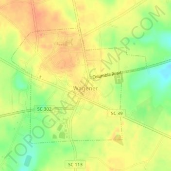
Name: Wagener topographic map, elevation, terrain.
Location: Wagener, Aiken County, South Carolina, United States (33.64363 -81.37530 33.66191 -81.34966)
Average elevation: 137 m
Minimum elevation: 109 m
Maximum elevation: 155 m
Thank you for supporting this site ❤️
Make a donation
Make a donation
Other topographic maps
Click on a map to view its topography, its elevation and its terrain.
Deerwood
United States > South Carolina > Aiken County > Aiken > Verandas on the Green
Average elevation: 136 m
Thank you for supporting this site ❤️
Make a donation
Make a donation
Thank you for supporting this site ❤️
Make a donation
Make a donation