
Thank you for supporting this site ❤️
Make a donation
Make a donation
Durkee topographic map
Click on the map to display elevation.
Thank you for supporting this site ❤️
Make a donation
Make a donation
About this map
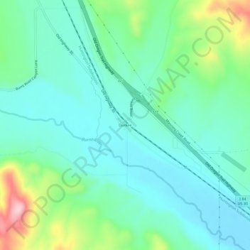
Name: Durkee topographic map, elevation, terrain.
Location: Durkee, Baker County, Oregon, 97905, United States (44.56211 -117.48464 44.60211 -117.44464)
Average elevation: 841 m
Minimum elevation: 781 m
Maximum elevation: 1,027 m
Thank you for supporting this site ❤️
Make a donation
Make a donation
Other topographic maps
Click on a map to view its topography, its elevation and its terrain.