
Thank you for supporting this site ❤️
Make a donation
Make a donation
Iron Mountain topographic map
Click on the map to display elevation.
Thank you for supporting this site ❤️
Make a donation
Make a donation
About this map
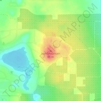
Name: Iron Mountain topographic map, elevation, terrain.
Location: Iron Mountain, Polk County, Florida, 33853, United States (27.93664 -81.57735 27.93674 -81.57725)
Average elevation: 60 m
Minimum elevation: 29 m
Maximum elevation: 97 m
Thank you for supporting this site ❤️
Make a donation
Make a donation
Other topographic maps
Click on a map to view its topography, its elevation and its terrain.