
Thank you for supporting this site ❤️
Make a donation
Make a donation
Riodeva topographic map
Click on the map to display elevation.
Thank you for supporting this site ❤️
Make a donation
Make a donation
About this map
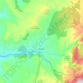
Name: Riodeva topographic map, elevation, terrain.
Location: Riodeva, Comunidad de Teruel, Teruel, Aragon, Spain (40.08851 -1.20130 40.16071 -1.09830)
Average elevation: 1,155 m
Minimum elevation: 850 m
Maximum elevation: 1,736 m
Thank you for supporting this site ❤️
Make a donation
Make a donation