
Thank you for supporting this site ❤️
Make a donation
Make a donation
Kyamugongo topographic map
Click on the map to display elevation.
Thank you for supporting this site ❤️
Make a donation
Make a donation
About this map
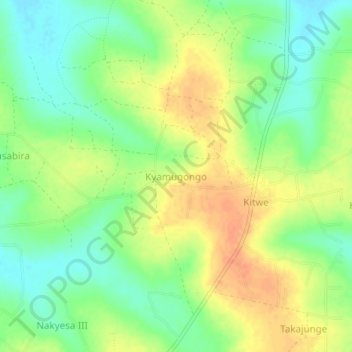
Name: Kyamugongo topographic map, elevation, terrain.
Location: Kyamugongo, Kayunga, Central Region, Uganda (0.93293 32.85423 0.97293 32.89423)
Average elevation: 1,075 m
Minimum elevation: 1,055 m
Maximum elevation: 1,095 m
Thank you for supporting this site ❤️
Make a donation
Make a donation