
Thank you for supporting this site ❤️
Make a donation
Make a donation
Nachá topographic map
Click on the map to display elevation.
Thank you for supporting this site ❤️
Make a donation
Make a donation
About this map
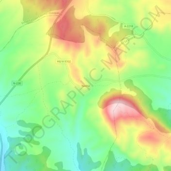
Name: Nachá topographic map, elevation, terrain.
Location: Nachá, Baells, La Litera, Huesca, Aragón, España (41.93649 0.47204 41.97649 0.51204)
Average elevation: 681 m
Minimum elevation: 547 m
Maximum elevation: 858 m
Thank you for supporting this site ❤️
Make a donation
Make a donation
Other topographic maps
Click on a map to view its topography, its elevation and its terrain.