
Thank you for supporting this site ❤️
Make a donation
Make a donation
Hode topographic map
Click on the map to display elevation.
Thank you for supporting this site ❤️
Make a donation
Make a donation
About this map
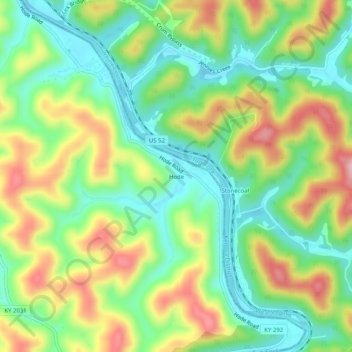
Name: Hode topographic map, elevation, terrain.
Location: Hode, Martin County, Kentucky, 41267, United States (37.86500 -82.44611 37.90500 -82.40611)
Average elevation: 258 m
Minimum elevation: 174 m
Maximum elevation: 385 m
Thank you for supporting this site ❤️
Make a donation
Make a donation
Other topographic maps
Click on a map to view its topography, its elevation and its terrain.