
Thank you for supporting this site ❤️
Make a donation
Make a donation
Sabattus topographic map
Click on the map to display elevation.
Thank you for supporting this site ❤️
Make a donation
Make a donation
About this map
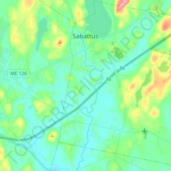
Name: Sabattus topographic map, elevation, terrain.
Location: Sabattus, Androscoggin County, Maine, 04280, United States (44.05093 -70.12679 44.13769 -70.00547)
Average elevation: 83 m
Minimum elevation: 51 m
Maximum elevation: 194 m
Thank you for supporting this site ❤️
Make a donation
Make a donation
Other topographic maps
Click on a map to view its topography, its elevation and its terrain.