
灵川县 topographic map
Interactive map
Click on the map to display elevation.
About this map
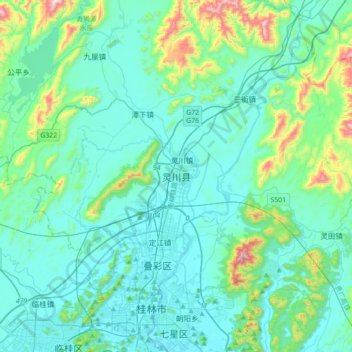
Name: 灵川县 topographic map, elevation, terrain.
Location: 灵川县, 桂林市, 广西壮族自治区, 中国 (25.23752 110.15616 25.55752 110.47616)
Average elevation: 253 m
Minimum elevation: 140 m
Maximum elevation: 886 m
Other topographic maps
Click on a map to view its topography, its elevation and its terrain.