
谢家寨 topographic map
Interactive map
Click on the map to display elevation.
About this map
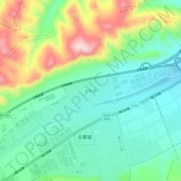
Name: 谢家寨 topographic map, elevation, terrain.
Location: 谢家寨, 南川工业园, 城中区, 西宁市, 青海省, 810000, 中国 (36.53074 101.66666 36.57074 101.70666)
Average elevation: 2,497 m
Minimum elevation: 2,382 m
Maximum elevation: 2,741 m
Other topographic maps
Click on a map to view its topography, its elevation and its terrain.