
Thank you for supporting this site ❤️
Make a donation
Make a donation
Chengamanadu topographic map
Click on the map to display elevation.
Thank you for supporting this site ❤️
Make a donation
Make a donation
About this map
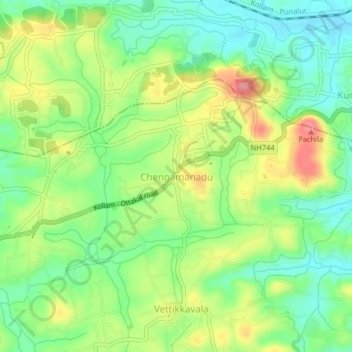
Name: Chengamanadu topographic map, elevation, terrain.
Location: Chengamanadu, Kottarakkara, Kollam, Kerala, 691557, India (8.99396 76.80591 9.03396 76.84591)
Average elevation: 60 m
Minimum elevation: 18 m
Maximum elevation: 121 m
Thank you for supporting this site ❤️
Make a donation
Make a donation