
Thank you for supporting this site ❤️
Make a donation
Make a donation
Kejobong topographic map
Click on the map to display elevation.
Thank you for supporting this site ❤️
Make a donation
Make a donation
About this map
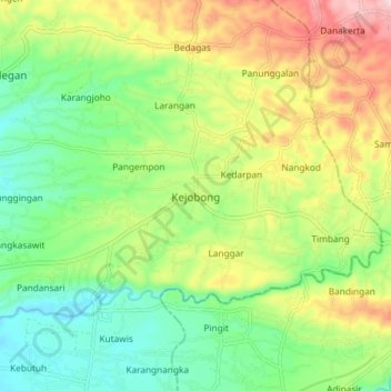
Name: Kejobong topographic map, elevation, terrain.
Location: Kejobong, Purbalingga, Central Java, Java, Indonesia (-7.43080 109.47074 -7.35080 109.55074)
Average elevation: 149 m
Minimum elevation: 59 m
Maximum elevation: 290 m
Thank you for supporting this site ❤️
Make a donation
Make a donation
Other topographic maps
Click on a map to view its topography, its elevation and its terrain.