
Thank you for supporting this site ❤️
Make a donation
Make a donation
Copley topographic map
Click on the map to display elevation.
Thank you for supporting this site ❤️
Make a donation
Make a donation
Copley
Copley has its own weather station run by the Met Office and Environment Agency. Because of its elevation above sea-level, around the 1,000 ft contour, and position in the north-east, this station is often one of the coldest in England with high incidences of ground frosts and snowfalls. Copley is in a relatively dry and sunny rain-shadow area in the shelter of the higher Pennines to the west. The same higher Pennines can create a local gusty effect if the wind blows from the west-south-west. This is called the Pennine Lee Wave and can appear suddenly and disappear just as quickly.
Thank you for supporting this site ❤️
Make a donation
Make a donation
About this map
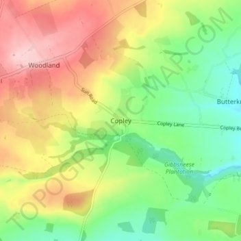
Name: Copley topographic map, elevation, terrain.
Average elevation: 261 m
Minimum elevation: 183 m
Maximum elevation: 358 m
Thank you for supporting this site ❤️
Make a donation
Make a donation