
Thank you for supporting this site ❤️
Make a donation
Make a donation
South Fulton topographic map
Click on the map to display elevation.
Thank you for supporting this site ❤️
Make a donation
Make a donation
About this map
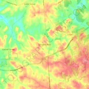
Name: South Fulton topographic map, elevation, terrain.
Location: South Fulton, Fulton County, Georgia, United States (33.55027 -84.71123 33.63027 -84.63123)
Average elevation: 272 m
Minimum elevation: 220 m
Maximum elevation: 319 m
Thank you for supporting this site ❤️
Make a donation
Make a donation
Other topographic maps
Click on a map to view its topography, its elevation and its terrain.