
Thank you for supporting this site ❤️
Make a donation
Make a donation
Lantek Temor topographic map
Click on the map to display elevation.
Thank you for supporting this site ❤️
Make a donation
Make a donation
About this map
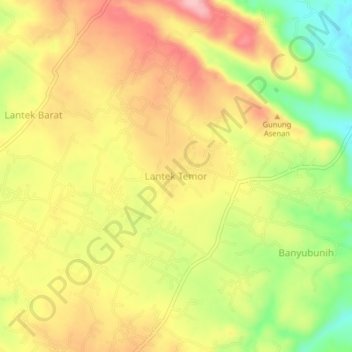
Name: Lantek Temor topographic map, elevation, terrain.
Location: Lantek Temor, Bangkalan, East Java, Indonesia (-7.10183 112.94871 -7.06183 112.98871)
Average elevation: 121 m
Minimum elevation: 34 m
Maximum elevation: 191 m
Thank you for supporting this site ❤️
Make a donation
Make a donation