
Thank you for supporting this site ❤️
Make a donation
Make a donation
Altmannstein topographic map
Click on the map to display elevation.
Thank you for supporting this site ❤️
Make a donation
Make a donation
About this map
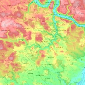
Name: Altmannstein topographic map, elevation, terrain.
Location: Altmannstein, Landkreis Eichstätt, Bavaria, 93336, Germany (48.85780 11.50798 48.96106 11.74421)
Average elevation: 445 m
Minimum elevation: 343 m
Maximum elevation: 548 m
Thank you for supporting this site ❤️
Make a donation
Make a donation
Other topographic maps
Click on a map to view its topography, its elevation and its terrain.