
三峡大坝 topographic map
Interactive map
Click on the map to display elevation.
About this map
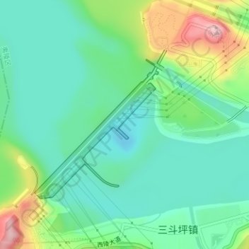
Name: 三峡大坝 topographic map, elevation, terrain.
Location: 三峡大坝, 夷陵区, 宜昌市, 湖北省, 中国 (30.81657 110.99619 30.83270 111.01281)
Average elevation: 95 m
Minimum elevation: 33 m
Maximum elevation: 250 m
1946年,資源委員會副委員長孙越崎(後來1983年第六屆全國政協經濟建設組組長,在任內對三峽工程提出反方意見的代表人)主持下,約翰·L·薩凡奇再度來華,與扬子江水利委员会组队入峡进行地形测量和经济调查。资源委员会分别与美国马力森公司、垦务局就坝区地质钻探、工程设计等事项签约。根据合约,46名中国工程技术人员赴美参与设计。钻探、航空测量等各项工作也逐渐展开。蔣介石在一次宴會向美國友人介紹三峽時,提到「你回美後請向總統(小羅斯福)報告,大壩告成,將取名為羅斯福水壩」(此根據資源委員會委員長錢昌照的回憶)
Other topographic maps
Click on a map to view its topography, its elevation and its terrain.