
Thank you for supporting this site ❤️
Make a donation
Make a donation
Kebnekaise topographic map
Click on the map to display elevation.
Thank you for supporting this site ❤️
Make a donation
Make a donation
About this map
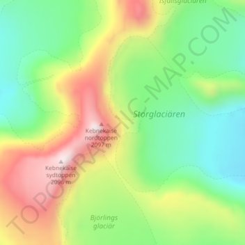
Name: Kebnekaise topographic map, elevation, terrain.
Location: Kebnekaise, Kiruna kommun, Norrbotten County, Sweden (67.90462 18.52923 67.90544 18.54020)
Average elevation: 1,656 m
Minimum elevation: 1,374 m
Maximum elevation: 2,116 m
Thank you for supporting this site ❤️
Make a donation
Make a donation