
Thank you for supporting this site ❤️
Make a donation
Make a donation
San Andres topographic map
Click on the map to display elevation.
Thank you for supporting this site ❤️
Make a donation
Make a donation
About this map
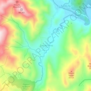
Name: San Andres topographic map, elevation, terrain.
Location: San Andres, Tanay, Rizal, Calabarzon, Philippines (14.61241 121.32693 14.65241 121.36693)
Average elevation: 411 m
Minimum elevation: 213 m
Maximum elevation: 719 m
Thank you for supporting this site ❤️
Make a donation
Make a donation
Other topographic maps
Click on a map to view its topography, its elevation and its terrain.