
Make a donation
Tysons topographic map
Click on the map to display elevation.
Make a donation
Tysons
Tysons is located at 38°55′7″N 77°13′47″W / 38.91861°N 77.22972°W / 38.91861; -77.22972 (38.918485, −77.229833) at an elevation of 486 feet (148 m). Located in Northern Virginia at the intersection of Virginia State Route 123 and State Route 7, Tysons is 11 miles (18 km) west of downtown Washington, D.C. and 6 miles (9.7 km) northeast of Fairfax, the county seat.
Make a donation
About this map
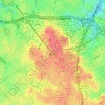
Name: Tysons topographic map, elevation, terrain.
Location: Tysons, Fairfax County, Virginia, 22103, United States (38.90340 -77.25444 38.93493 -77.19624)
Average elevation: 122 m
Minimum elevation: 75 m
Maximum elevation: 164 m
Make a donation
Other topographic maps
Click on a map to view its topography, its elevation and its terrain.
Make a donation
George Washington's Mount Vernon
United States > Virginia > Fairfax County > Mount Vernon
Visitors to Mount Vernon now see Washington's study, a room to which in the 18th century only a privileged few were granted entry. This simply furnished room has a combined bathroom, dressing room and office; the room was so private that few contemporary descriptions exist. Its walls are lined with naturally…
Average elevation: 14 m
Izaak Walton League of America - Arlington-Fairfax Chapter
United States > Virginia > Fairfax County > Centreville
Average elevation: 72 m
Make a donation
Make a donation
Make a donation
Mount Vernon Community Park
United States > Virginia > Fairfax County > Fort Hunt > Snowden
Average elevation: 14 m
Make a donation
Shirley Gate Park
United States > Virginia > Fairfax County > George Mason > Shirley Gate Park
Average elevation: 128 m
Make a donation