
Thank you for supporting this site ❤️
Make a donation
Make a donation
Jiangcheng topographic map
Click on the map to display elevation.
Thank you for supporting this site ❤️
Make a donation
Make a donation
About this map
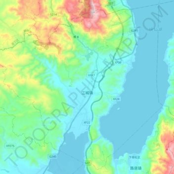
Name: Jiangcheng topographic map, elevation, terrain.
Location: Jiangcheng, Jiangchuan District, Yuxi, Yunnan, China (24.34335 102.69124 24.52055 102.89549)
Average elevation: 1,901 m
Minimum elevation: 1,718 m
Maximum elevation: 2,637 m
Thank you for supporting this site ❤️
Make a donation
Make a donation
Other topographic maps
Click on a map to view its topography, its elevation and its terrain.