
Pinot topographic map
Interactive map
Click on the map to display elevation.
About this map
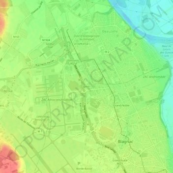
Name: Pinot topographic map, elevation, terrain.
Average elevation: 144 m
Minimum elevation: 115 m
Maximum elevation: 178 m
Other topographic maps
Click on a map to view its topography, its elevation and its terrain.
Borde-Basse
France > Occitanie > Haute-Garonne > Blagnac
Borde-Basse, Blagnac, Toulouse, Haute-Garonne, Occitanie, France métropolitaine, 31700, France
Average elevation: 151 m
Grand-Noble
France > Occitanie > Haute-Garonne > Blagnac
Grand-Noble, Blagnac, Toulouse, Haute-Garonne, Occitanie, France métropolitaine, 31700, France
Average elevation: 141 m