
Thank you for supporting this site ❤️
Make a donation
Make a donation
Burr Hill topographic map
Click on the map to display elevation.
Thank you for supporting this site ❤️
Make a donation
Make a donation
About this map
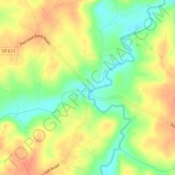
Name: Burr Hill topographic map, elevation, terrain.
Location: Burr Hill, Orange County, Virginia, 22433, United States (38.33402 -77.86972 38.35402 -77.84972)
Average elevation: 102 m
Minimum elevation: 76 m
Maximum elevation: 123 m
Thank you for supporting this site ❤️
Make a donation
Make a donation
Other topographic maps
Click on a map to view its topography, its elevation and its terrain.