
Thank you for supporting this site ❤️
Make a donation
Make a donation
Almendral de la Cañada topographic map
Click on the map to display elevation.
Thank you for supporting this site ❤️
Make a donation
Make a donation
About this map
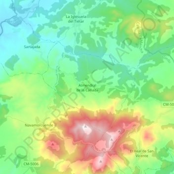
Name: Almendral de la Cañada topographic map, elevation, terrain.
Location: Almendral de la Cañada, Toledo, Castile-La Mancha, Spain (40.15030 -4.86007 40.21628 -4.69570)
Average elevation: 689 m
Minimum elevation: 400 m
Maximum elevation: 1,365 m
Thank you for supporting this site ❤️
Make a donation
Make a donation