
Thank you for supporting this site ❤️
Make a donation
Make a donation
West Wendover topographic map
Click on the map to display elevation.
Thank you for supporting this site ❤️
Make a donation
Make a donation
About this map
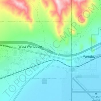
Name: West Wendover topographic map, elevation, terrain.
Location: West Wendover, Elko County, Nevada, United States (40.72549 -114.11298 40.75567 -114.04361)
Average elevation: 1,423 m
Minimum elevation: 1,288 m
Maximum elevation: 1,812 m
Thank you for supporting this site ❤️
Make a donation
Make a donation
Other topographic maps
Click on a map to view its topography, its elevation and its terrain.