
Thank you for supporting this site ❤️
Make a donation
Make a donation
Gothinda topographic map
Click on the map to display elevation.
Thank you for supporting this site ❤️
Make a donation
Make a donation
About this map
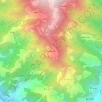
Name: Gothinda topographic map, elevation, terrain.
Location: Gothinda, Srinthal, Tharali, Chamoli, Uttarakhand, India (30.04811 79.53576 30.08811 79.57576)
Average elevation: 1,875 m
Minimum elevation: 1,231 m
Maximum elevation: 2,585 m
Thank you for supporting this site ❤️
Make a donation
Make a donation