
Thank you for supporting this site ❤️
Make a donation
Make a donation
Weaverville topographic map
Click on the map to display elevation.
Thank you for supporting this site ❤️
Make a donation
Make a donation
About this map
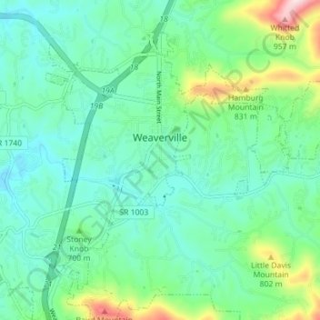
Name: Weaverville topographic map, elevation, terrain.
Location: Weaverville, Buncombe County, North Carolina, United States (35.66960 -82.58549 35.71560 -82.51515)
Average elevation: 679 m
Minimum elevation: 593 m
Maximum elevation: 962 m
Thank you for supporting this site ❤️
Make a donation
Make a donation