
Thank you for supporting this site ❤️
Make a donation
Make a donation
Sugar Pine Point topographic map
Click on the map to display elevation.
Thank you for supporting this site ❤️
Make a donation
Make a donation
About this map
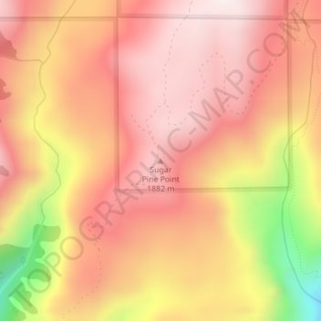
Name: Sugar Pine Point topographic map, elevation, terrain.
Location: Sugar Pine Point, Placer County, California, United States (39.24680 -120.54442 39.24690 -120.54432)
Average elevation: 1,737 m
Minimum elevation: 1,258 m
Maximum elevation: 1,972 m
Thank you for supporting this site ❤️
Make a donation
Make a donation
Other topographic maps
Click on a map to view its topography, its elevation and its terrain.
Thank you for supporting this site ❤️
Make a donation
Make a donation
North Tahoe Regional Park
United States > California > Placer County > Tahoe Vista
Average elevation: 2,007 m
Thank you for supporting this site ❤️
Make a donation
Make a donation