
Thank you for supporting this site ❤️
Make a donation
Make a donation
Elmore topographic map
Click on the map to display elevation.
Thank you for supporting this site ❤️
Make a donation
Make a donation
About this map
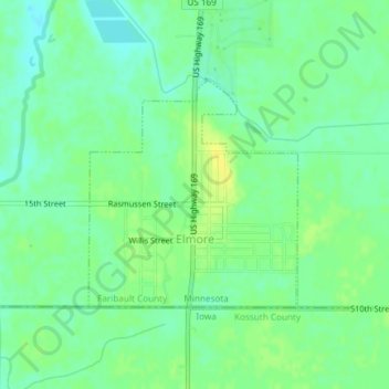
Name: Elmore topographic map, elevation, terrain.
Location: Elmore, Faribault County, Minnesota, United States (43.50001 -94.09819 43.51584 -94.07813)
Average elevation: 341 m
Minimum elevation: 332 m
Maximum elevation: 351 m
Thank you for supporting this site ❤️
Make a donation
Make a donation
Other topographic maps
Click on a map to view its topography, its elevation and its terrain.