
Thank you for supporting this site ❤️
Make a donation
Make a donation
Mount Talang topographic map
Click on the map to display elevation.
Thank you for supporting this site ❤️
Make a donation
Make a donation
About this map
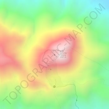
Name: Mount Talang topographic map, elevation, terrain.
Location: Mount Talang, Solok, West Sumatra, Sumatra, Indonesia (-0.97907 100.67990 -0.97897 100.68000)
Average elevation: 2,165 m
Minimum elevation: 1,758 m
Maximum elevation: 2,579 m
Thank you for supporting this site ❤️
Make a donation
Make a donation
Other topographic maps
Click on a map to view its topography, its elevation and its terrain.