
Thank you for supporting this site ❤️
Make a donation
Make a donation
Van Nuys topographic map
Click on the map to display elevation.
Thank you for supporting this site ❤️
Make a donation
Make a donation
About this map
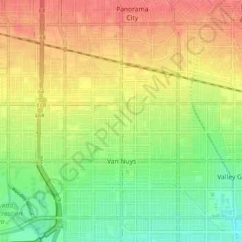
Name: Van Nuys topographic map, elevation, terrain.
Average elevation: 228 m
Minimum elevation: 199 m
Maximum elevation: 255 m
Thank you for supporting this site ❤️
Make a donation
Make a donation
Other topographic maps
Click on a map to view its topography, its elevation and its terrain.
Highland Camrose Park
United States > California > Los Angeles County > Los Angeles
Average elevation: 186 m