
Thank you for supporting this site ❤️
Make a donation
Make a donation
Logan Township topographic map
Click on the map to display elevation.
Thank you for supporting this site ❤️
Make a donation
Make a donation
About this map
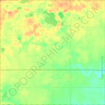
Name: Logan Township topographic map, elevation, terrain.
Location: Logan Township, Ogemaw County, Michigan, United States (44.24796 -84.00496 44.33482 -83.88318)
Average elevation: 260 m
Minimum elevation: 239 m
Maximum elevation: 285 m
Thank you for supporting this site ❤️
Make a donation
Make a donation
Other topographic maps
Click on a map to view its topography, its elevation and its terrain.